Le sud Seine-et-Marne à Vélo
La petite reine a le vent en poupe ! Rupture de stock un peu partout, la crise sanitaire est passée par là et a réveillé le côté « cycliste » qui est en vous !
Ça tombe bien car notre beau département regorge de parcours à vélo, à la campagne, en forêt, au bord de l’eau… et si vous ne le savez pas encore, le territoire est traversé par une Eurovéloroute !
Alors huilez votre chaîne, gonflez vos pneus, préparez votre casque et de quoi vous désaltérer car on vous emmène à la découverte de la Scandibérique !
La Scandibérique d’un bout à l’autre

La Scandibérique est le nom français de l’Eurovéloroute 3 qui relie Trondheim en Norvège à Saint-Jacques de Compostelle en Espagne. Un périple plus de 5 000 km traversant le Danemark, l’Allemagne, la Belgique et la France.
La Scandibérique traverse le territoire français du nord au sud en passant par l’Ile-de-France. Pour le moment seule une partie du parcours a été aménagé en Seine-et-Marne, de Bois-le-Roi jusqu’ à Souppes-sur-Loing. Au total ce sont 60 km de chemins et une signalétique mise en place afin d’assurer la sécurité de tous. Le parcours peut être fait dans les deux sens bien entendu, en famille, en solo ou entre amis.
Au départ de Bois-le-Roi, en particulier de la gare, vous démarrerez en douceur sur les bords de Seine, vous vous arrêterez certainement pour admirer les belles villas appelées « les Affolantes », des maisons bourgeoises construites au 19ème siècle aux architectures atypiques, véritables lieux de villégiature.
Le circuit passe par la l’Ile de Loisirs de Bois-le-Roi, des aires de pique-nique sont à disposition, et s’il fait chaud une petite baignade sera peut-être appréciée…
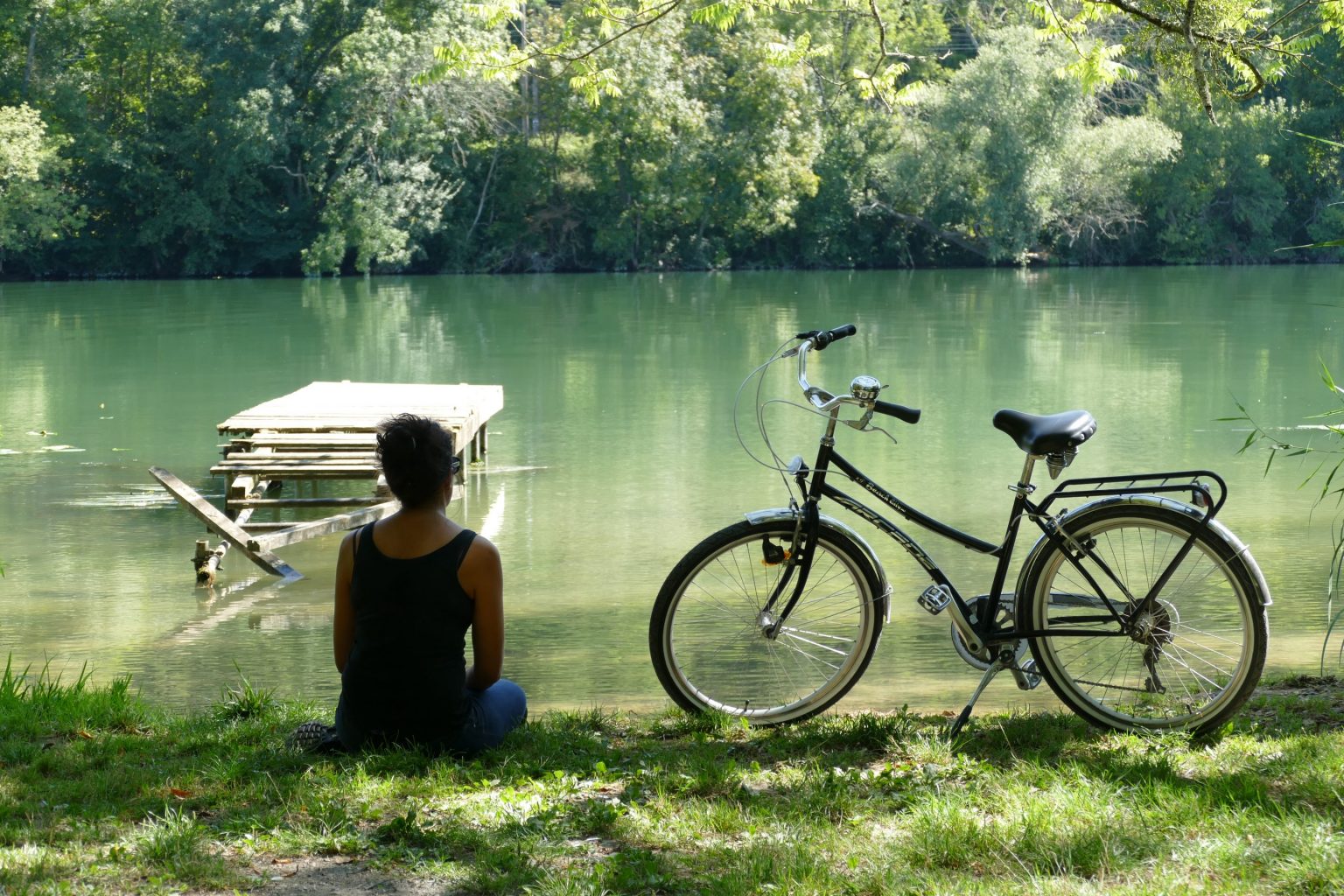
En sortant de la base (attention en traversant la départementale) vous emprunterez un chemin de forêt au bord de la Seine, c’est un nouveau décor, des arbres, puis, comme une fenêtre ouverte… apparaît une clairière, des arbres à papillons, un ponton abandonné, une lumière particulière s’échappe de cette ambiance végétale…. Une pause photos ?
C’est reparti pour le village de Samois-sur-Seine, arrivés par les champs, nous ne sommes pas surpris qu’il ait obtenu le label « Villages de Caractère » car il est à la hauteur de sa notoriété. Tout d’abord son charme, on retrouve les somptueuses villas « les Affolantes », toutes plus belles les unes que les autres et alignées comme si elles participaient à un défilé. Ensuite ce sont les terrasses des restaurants et des bars au bord de la Seine qui pourraient rappeler les fameuses guinguettes des bords de Marne ! Enfin, Samois est aussi célèbre car il a accueilli pendant près de 50 ans le Festival de Jazz Django Reinhardt. Il se déroulait sur l’Ile du Berceau, on y accède par une passerelle… empruntez-la et arrêtez-vous sur un banc, imaginez l’empreinte laissé par ce festival de musique et ressentez l’ambiance qui régnait dans cette commune chaque année au son du jazz manouche…

Pour accéder à Vulaines-sur-Seine et Samoreau, il faudra traverser le pont de Valvins, faites attention à la circulation ! Si vous avez un peu de temps, de l’autre côté de la Seine à Vulaines, arrêtez-vous au Musée Départemental Stéphane Mallarmé, visitez la dernière demeure de ce poète et son beau jardin qui incite à la rêverie.
En continuant toujours le long de la Seine, vous passerez près de l’étang de Samoreau, une buvette y est installée depuis de nombreuses années et une halte rafraîchissante ne sera pas de refus aux beaux jours !
A Champagne-sur-Seine il ne faudra pas rater une bifurcation vers l’Espace Naturel Sensible des Basses Godernes, situé en rive droite d’une boucle du fleuve. Une superficie de 11 hectares aménagés autour d’un étang qui offrent un beau spectacle botanique et ornithologique mais également une plateforme d’observation de la confluence entre la Seine et le Loing.

Les paysages défilent sur votre vélo, rivages, péniches, sur l’autre rive une magnifique bâtisse et puis c’est le village de caractère de Saint-Mammès, une commune ancrée dans un passé de batellerie. Les mariniers s’y sont peu à peu installés pour de bon et ont façonné ce village à leur image. En effet l’espace-rue est réduit à d’étroites venelles qui serpentent de cour en cour et de jardin en jardin. Ce parcellaire, très original, est à l’échelle de l’espace exigu dont se contentaient les mariniers sur leurs péniches. Prenez le temps de vous balader dans ces venelles, vous serez surpris par cet environnement si particulier qui fait de Saint-Mammès un village où il fait bon vivre et on comprend facilement pourquoi les mariniers en ont fait leur port d’attache. Un musée leur est d’ailleurs consacré, avec un peu de chance il sera ouvert lors de votre passage !
Vous pédalez désormais jusqu’à Moret-Loing-et-Orvanne (autrefois Moret-sur-Loing) arrivés à l’écluse du canal du Loing, traversez la route et vous serez sur le site Prugnat, un Musée du Vélo vous y attend ! Si vous pouvez, allez faire un tour du côté du centre-ville vous ne serez pas déçus. Cette ville au passé médiéval a conservé deux portes monumentales de cette époque, vous rentrerez dans la ville par la porte de Bourgogne tel un chevalier sur sa monture, la vôtre sera la petite reine !
Vous découvrirez comment Moret a inspiré l’artiste impressionniste et véritable icône de l’époque, Alfred Sisley, et comment des religieuses sont à l’origine de la fabrication de véritables péchés mignons, les sucres d’orge !

Pour éviter de repartir sur le site Prugnat et reprendre l’itinéraire de la Scandibérique vous pourrez rattraper le parcours en vous rendant au lieudit le faubourg d’Ecuelles. Il est la porte d’entrée du chemin de halage qui longe le canal du Loing et vous emmène vers la fin de votre périple.
Arrivés à l’écluse de l’Auberge d’Episy, il est temps de changer de rive et de passer de l’autre côté du canal du Loing. C’est ici et plus particulièrement à l’Espace Naturel Sensible du Marais d’Episy que sera votre prochaine pause, un havre de paix pour la faune et la flore présentes sur le site. Des plateformes d’observation vous obligeront à vous poser quelques minutes et à contempler le spectacle de cette mosaïque de milieux humides, étangs, prairies, marais… Cet espace naturel est également inscrit sur la « liste verte » des 5 aires protégées les mieux gérées en France. Le marais abrite également une quarantaine d’espèces de libellules dont 70% sont présentes en Ile-de-France et se retrouvent ici à Episy.
=> C’est d’ailleurs à Episy que vous pouvez poser vos bagages pour une nuit ou plus dans la chambre d’hôtes La Pommerie. Alexandra vous accueille dans une ancienne ferme rénovée, cosy, fleurie et avec tout le confort nécessaire pour vous détendre.

Une fois revitalisés, reprenez la route direction Nemours, vous traverserez les villages de La Genevraye et sa très belle église Saint-Martin, bâtie sur une éminence à l’écart du village. Vous y trouverez également une brasserie, la Pachamama, et à Moncourt-Fromonville, en face du restaurant « Le Chabada » vous pourrez embarquer sur le ZIA pour une croisière sur le canal du Loing jusqu’à Nemours !

Nemours, cité médiévale des bords du Loing, elle a tout le charme d’une petite ville de province. Le Château-Musée de Nemours et le Musée de Préhistoire d’Ile-de-France témoignent de son long passé historique, de la préhistoire à nos jours et en passant par l’époque médiéval. Le Musée de Préhistoire est d’ailleurs accessible depuis la Scandibérique. Quant au Château-Musée, il est le symbole de cette ville, cet édifice du XIIe siècle est l’un des seuls châteaux de ville en Ile-de-France à être encore intact. Il est riche d’environ 20 000 œuvres constituées d’arts graphiques (estampes, dessins, photographies), de peintures et de sculptures de l’art de la fin du XIXe siècle et du début du XXe siècle. Il est également un lieu d’exploration, de découverte et de culture rythmé par des expositions temporaires depuis 2008 (après trois ans de fermeture et plusieurs mois de travaux de rénovation).
Dernière étape vers le point final de ce tronçon de la Scandibérique, Souppes-sur-loing. Labellisée Pavillon Bleu depuis 16 années pour ses efforts en matière d’environnement, grâce à sa base de loisirs, cette ville d’histoire vous invite à découvrir son église, son abbaye cistercienne, ses carrières de pierre, son ancienne Seigneurie et ses polissoirs néolithiques. Car c’est justement à la pierre calcaire de son sol que la ville doit sa renommée mais également à son abbaye cistercienne, l’Abbaye Royale Notre-Dame de Cercanceaux, occupée par des moines au 12ème siècle. Elle est désormais une propriété privée mais l’Office de Tourisme de Gâtinais Val-de-Loing organise des visites.

Rien ne vous empêche de continuer sur votre lancée et d’explorer d’autre contrées mais sachez qu’il y a tellement à voir dans notre département qu’il faudra vous y prendre à plusieurs fois !
Sans compter qu’il existe plusieurs itinéraires bis à la Scandibérique, on vous laisse les découvrir !
Les itinéraires bis de la Scandibérique
Si vous voulez rouler hors des sentiers battus, on vous propose des itinéraires bis, non loin des chemins balisés bifurquez vers des endroits, des villes ou des villages qui en valent le détour !
A la sortie de Samois-sur-Seine, au pont de Valvins, au lieu de traverser le pont, passez au-dessous et suivez la piste cyclable qui vous mènera jusqu’à Fontainebleau. Le parc public du Château de Fontainebleau (c’est là désormais qu’à lieu le festival de jazz Django Reinhart) sera votre porte d’entrée dans la ville impériale. Une visite de la demeure des rois de France pourrait être une option, mais il faudra prendre son temps car le château est un bon résumé de l’histoire de France qui a vu défilé de nombreux rois, de Philippe Auguste à Napoléon ! Les jardins se visitent également, jardin de Diane, jardin anglais, jardin à la Française, une variété de d’essences végétales et même un étang majestueux où l’on peut faire une balade en barque.
A Champagne, prenez la direction de Thomery , là-bas vous attend la dernière demeure de l’artiste peintre animalière Rosa Bonheur, une passionnée a restauré sa dernière demeure, le château de By, et en a fait un musée. Si vous souhaitez faire une étape durant votre voyage, le château dispose de chambres d’hôtes et d’un salon de thé.
A Episy, si l’appel de la forêt se fait ressentir, nous vous incitons à rouler vers Montigny-sur-Loing, un village charmant entre eau et forêt, sur votre route il y aura la Plaine de Sorques , encore un Espace Naturel Sensible. Arrivés à Montigny, poussez jusqu’au village accolé, Bourron-Marlotte, les Délices de la Ruche vous attentent pour une dégustation de miel au goût de luzerne, vous serez sûrement tentés par leur pain d’épice et leurs galettes !
A Montcourt, faîtes un détour par le village de caractère de Grez-sur-Loing, un village qui lui aussi a inspiré bon nombre d’artistes du monde entier au 19ème siècle, son pont a d’ailleurs fait le tour du monde et a inspiré un non moins célèbre artiste peintre japonais Kuroda Seiki, précurseur dans son pays de la peinture moderne de style occidental.
Alors on espère vous avoir donné envie d’enfourcher votre vélo et partir à la découverte de ces territoires du sud Seine-et-Marne ? L’important est de le faire à votre rythme, en prenant le temps de vous arrêter et d’admirer l’environnement qui vous entoure, chacun sa vitesse de croisière et le parcours peut être sectionné et ainsi s’adapter aux familles ou aux cyclistes moins expérimentés qui recherchent plus une balade qu’une performance !
Et si vous voulez un aperçu du sud de la Seine-et-Marne à vélo, retrouvez l’expérience de la blogueuse Madame Oreille.
Plongez dans son carnet de voyage que nous avions concocté spécialement pour elle et sa fille.
Bon voyage sur les chemins de la Scandibérique sud Seine-et-Marne !
Bonnes adresses
